07: Svalbard and Jan Mayen#
This region encompasses all glaciers in Svalbard and Jan Mayen.
Subregions
07-01: Svalbard
07-02: Jan Mayen
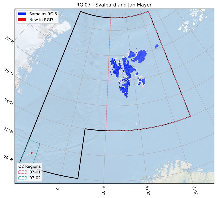
Fig. 33 Regional glacier area. Download high resolution version.#
Changes from version 6.0 to 7.0#
Jan Mayen
The RGI 6.0 glacier outlines referred to 1975, and therefore were replaced by new outlines closer to the target year 2000. Outlines were mapped from a Landsat 7 ETM+ scene (217-010) acquired on 13 September 2002 with the band ratio method (panchromatic band divided by the resampled SWIR band) and some manual corrections. New ice divides were derived from a flow direction grid that was calculated from the ArcticDEM (5 m mosaic).
Additional information#
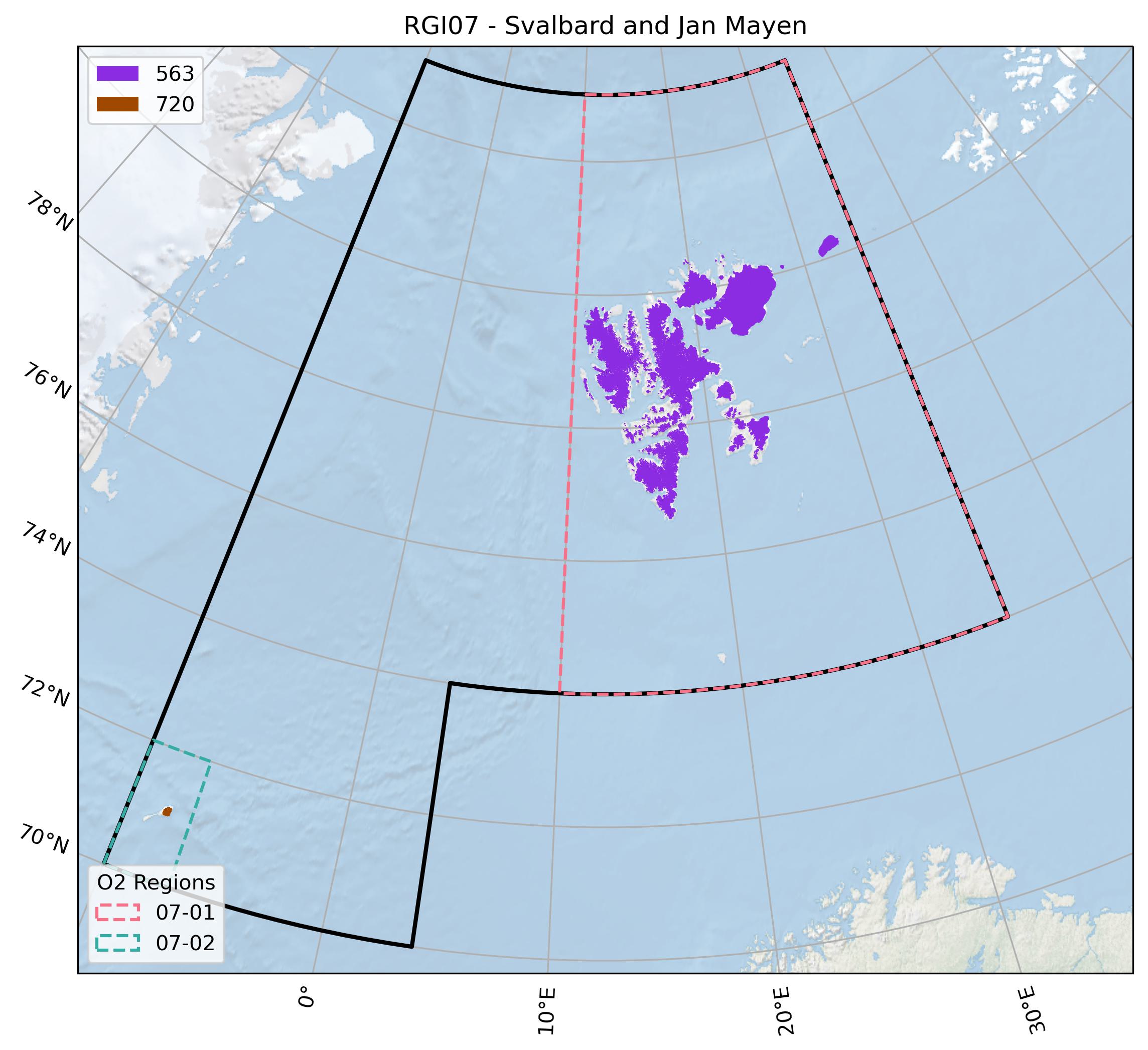
Data sources and analysts

Fig. 34 Submission IDs used for this region Download high resolution version.#
Glacier outline providers to GLIMS
This list includes the providers of the outlines used in the RGI 7.0 as generated automatically from the GLIMS outlines metadata. We acknowledge that the list may be incomplete due to omissions in the GLIMS database.
- Submission 563
Submitter: Koenig, Max.
Number of outlines: 1583. Area: 33841.4km². Release date: 2012-12-04.
Analysts: Koenig, Max; Nuth, Chris.- Submission 720
Submitter: Paul, Frank.
Number of outlines: 83. Area: 117.5km². Release date: 2021-08-03.
Analysts: Paul, Frank.- Reviewers
None;
Regional statistics
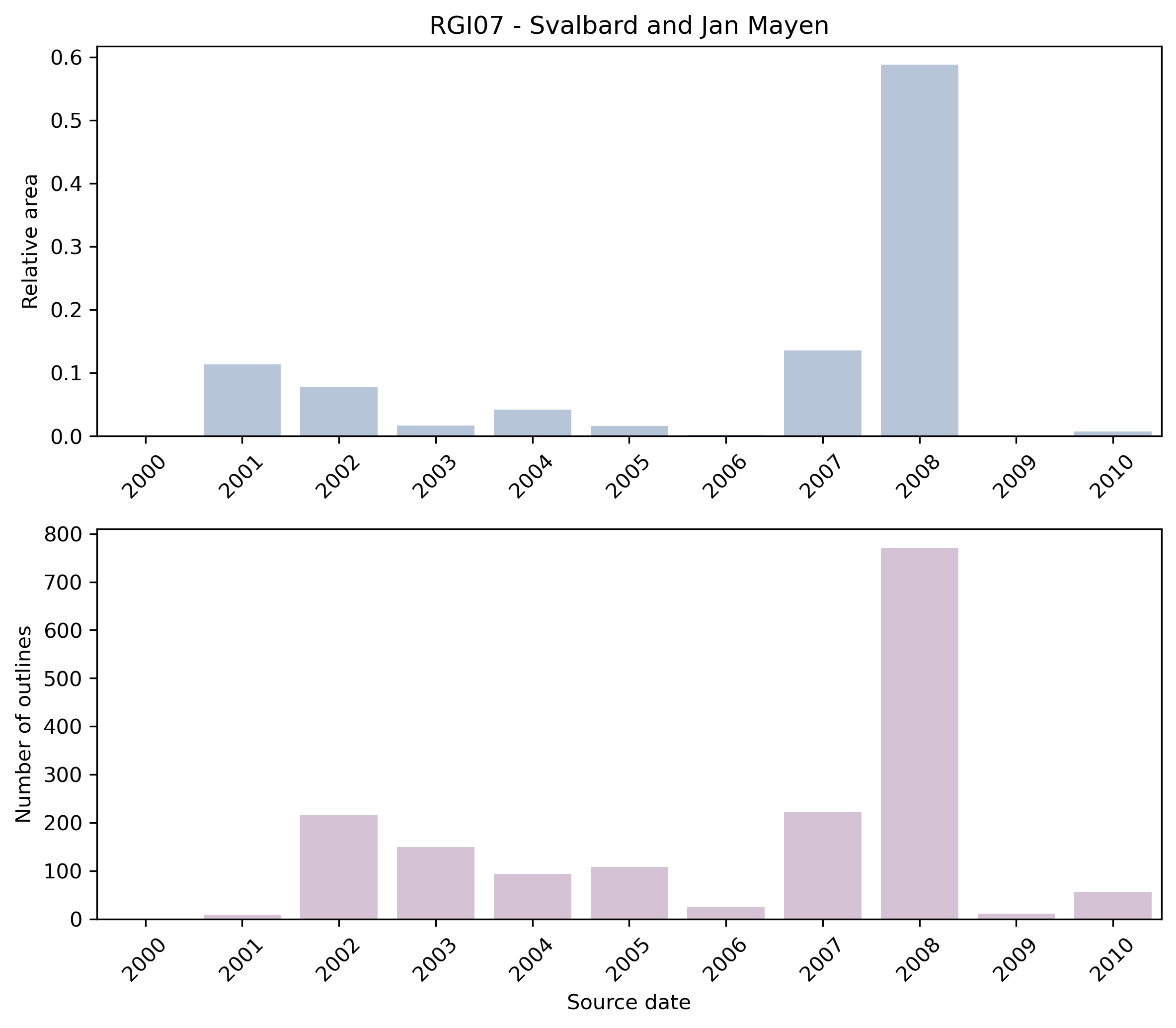
Fig. 35 Distribution of the outline dates per area (top) and number (bottom)#
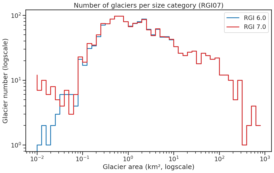
Fig. 36 Number of glaciers per size category (log-log scale).#
Regional number of glaciers (N) and area (km²) per terminus type in RGI 7.0 and RGI 6.0. Note that the default designation in RGI 7.0 is now “Not assigned”, while in RGI 6.0 lake-terminating glaciers and shelf-terminating glaciers were identified in some regions. The RGI region 19 is entirely labelled as “Not assigned” in RGI 7.0.
Value |
Terminus type |
RGI 7.0 (N) |
RGI 6.0 (N) |
RGI 7.0 (Area) |
RGI 6.0 (Area) |
|---|---|---|---|---|---|
0 |
Land-terminating |
0 |
1474 |
0 |
19069 |
1 |
Marine-terminating |
196 |
141 |
24051 |
14890 |
2 |
Lake-terminating |
0 |
0 |
0 |
0 |
3 |
Shelf-terminating |
0 |
0 |
0 |
0 |
9 |
Not assigned |
1470 |
0 |
9908 |
0 |
Regional number of glaciers (N) and area (km²) per surge type attribute in RGI 7.0 and RGI 6.0.
Value |
Surge type |
RGI 7.0 (N) |
RGI 6.0 (N) |
RGI 7.0 (Area) |
RGI 6.0 (Area) |
|---|---|---|---|---|---|
0 |
No evidence |
1403 |
1324 |
16656 |
17259 |
1 |
Possible |
103 |
103 |
2879 |
3256 |
2 |
Probable |
35 |
37 |
2276 |
3581 |
3 |
Observed |
125 |
103 |
12148 |
9741 |
9 |
Not assigned |
0 |
48 |
0 |
121 |
Version history
- Changes from Version 5.0 to 6.0
The source for hypsometry was changed from the ASTER GDEM2 to the ViewfinderPanoramas DEM3 (http://www.viewfinderpanoramas.org/).
- Changes from Version 4.0 to 5.0
Links were added to 9 glaciers in the WGMS mass-balance database.
- Changes from Version 3.2 to 4.0
One exterior GLIMSId was replaced. Topographic and hypsometric attributes were added.
In earlier versions, dates were omitted for 119 glaciers (total area 9,770 km2). They have now been restored from the inventory of Nuth et al. [2013]. The new dates were extracted from filecryoclim_gao_sj_2001-2010.zip, downloaded from https://data.npolar.no/dataset/89f430f8-862f-11e2-8036-00505bad0004. The newly-dated glaciers, RGI40-07.01449 to RGI40-07.01567, were matched on-screen one by one between RGI 4.0 and the Nuth shapefile.- Changes from Version 3.0 to 3.2
None.
- Changes from Version 2.0 to Version 3.0
None.
- Changes from Version 1.0 to Version 2.0
Outlines of the glaciers on Jan Mayen (07-02) were digitized by J.G. Cogley from Hagen et al. [1993].
- Version 1.0
The Svalbard inventory is described in more detail by Nuth et al. [2013].
Three primary data sets are used. The main sources are SPOT5-HRS DEMs and orthoimages provided within the framework of the IPY-SPIRIT (SPOT 5 stereoscopic survey of Polar Ice: Reference Images and Topographies) Project [Korona et al., 2009]. The SPOT5-HRS collects 5m panchromatic stereo images that are stereoscopically processed into 40m DEMs, then used to generate the orthoimages. Five SPIRIT scene acquisitions from 2007-2008 cover 71% of the glacier area. The secondary source is 23 scenes from the ASTER sensor in the form of automatically generated DEMs and orthoimages (AST14DMO products downloaded from NASA) covering 16% of the glacier area. Cloud-free scenes are not available for 2007-2008, and therefore data from as early as 2001 are used. For less than 14% of the glacier area, a suitable SPOT5-HRS or ASTER scene was not available. For these glaciers, 11 orthorectified Landsat scenes are used. Furthermore, additional Landsat and ASTER scenes are used to aid digitization decisions about the seasonal snow cover.
The original glacier delineation and glacier identification system is based on the Hagen et al. [1993] atlas, which conforms to WGI standards but is only available as a hard copy. Therefore, digitized national datasets are the base glacier masks from which to begin the inventory [König et al., 2014]. From this original dataset, we manually re-delineated the individual glacier basins based upon the Hagen et al. [1993] Atlas and updated by trimming the front position and the lateral edges below the ELA. Since the original national dataset was derived by cartographers, many of the mask segments above the ELA contained snow covered valley walls and gullies (not perennially snow covered). These are, to the best of our ability, clipped from the masks by visually analyzing the recent satellite archives of ASTER and Landsat.