08: Scandinavia#
This region encompasses all glaciers in Scandinavia. Glaciers on Svalbard are included in region 07.
Subregions
08-01: North Scandinavia
08-02: Southwest Scandinavia
08-03: Southeast Scandinavia
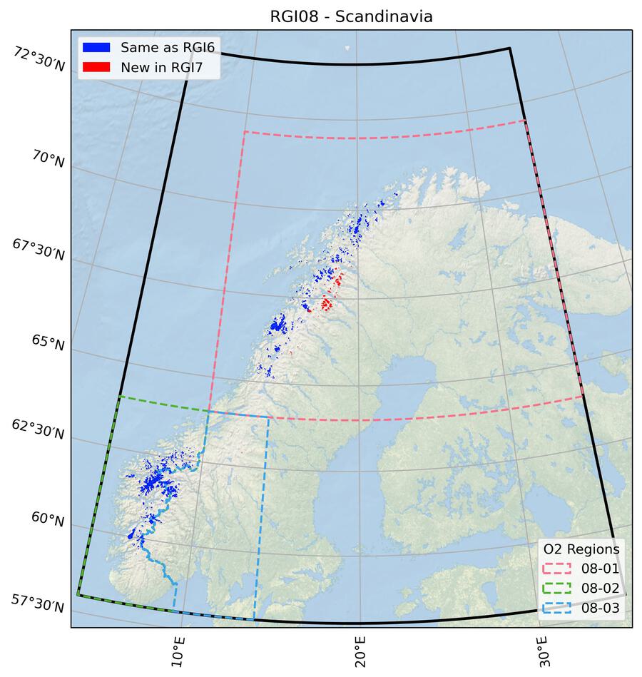
Fig. 37 Regional glacier area. Download high resolution version.#
Changes from version 6.0 to 7.0#
Kebnekaise massif in Sweden
All glaciers near the Kebnekaise massif have been corrected for a map projection shift. Four “nominal glaciers” (glaciers represented by a circle since no outlines were available) in the east of the region were deleted, as they do not appear to be glaciers.
Additional information#
Data sources and analysts
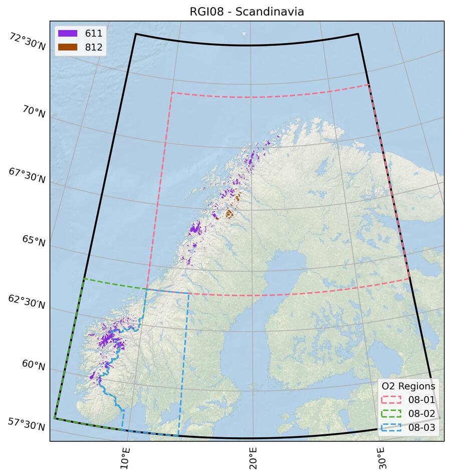
Fig. 38 Submission IDs used for this region Download high resolution version.#
Glacier outline providers to GLIMS
This list includes the providers of the outlines used in the RGI 7.0 as generated automatically from the GLIMS outlines metadata. We acknowledge that the list may be incomplete due to omissions in the GLIMS database.
- Submission 611
Submitter: Winsvold, Solveig Havstad.
Number of outlines: 3141. Area: 2674.8km². Release date: 2012-12-13.
Analysts: Andreassen, Liss Marie; Winsvold, Solveig Havstad.- Submission 812
Submitter: Frank, Thomas.
Number of outlines: 269. Area: 273.0km². Release date: 2023-01-02.
Analysts: Brown, Ian; Frank, Thomas; Hansson, Erik.- Reviewers
Mannerfelt, Erik;
Regional statistics
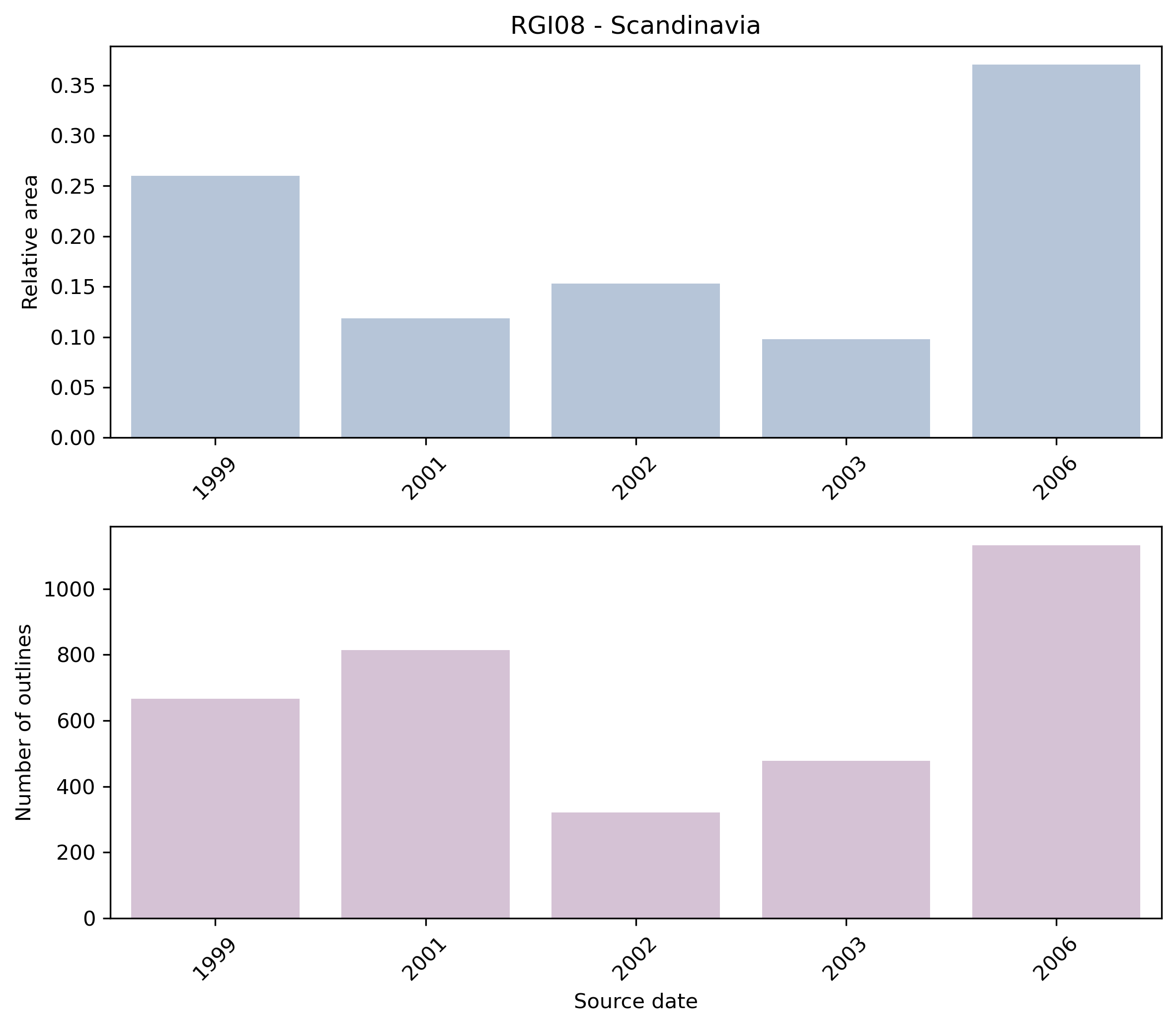
Fig. 39 Distribution of the outline dates per area (top) and number (bottom)#
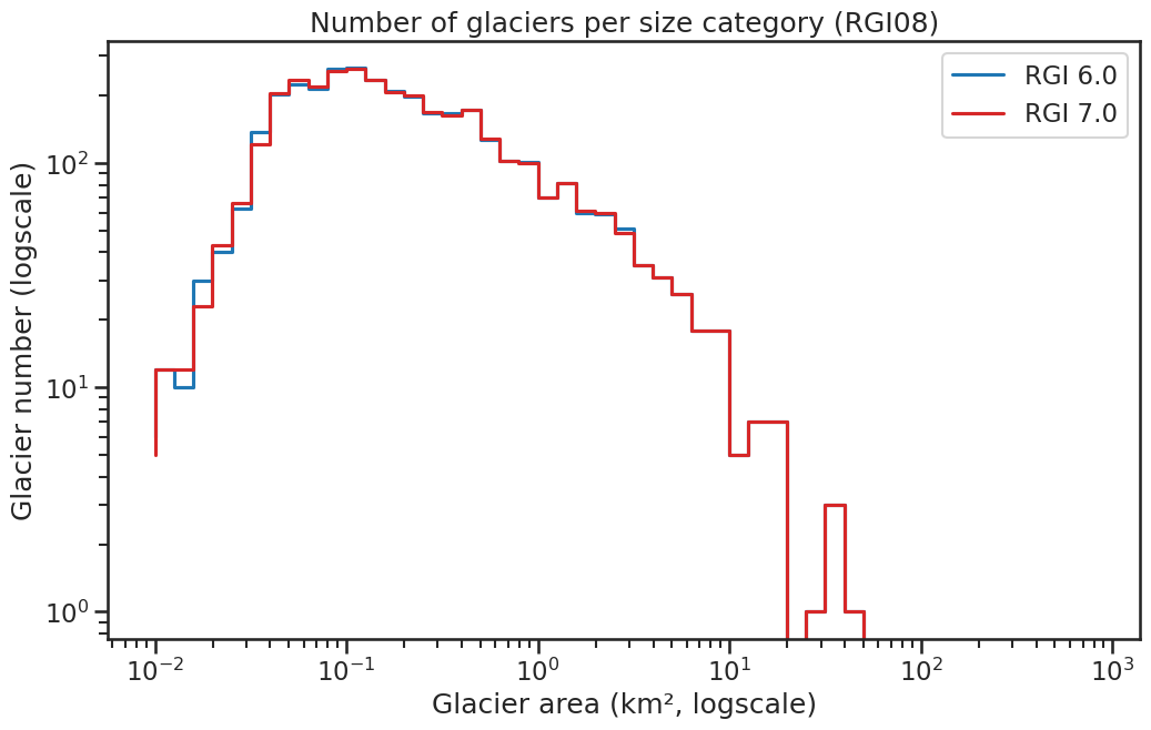
Fig. 40 Number of glaciers per size category (log-log scale).#
Regional number of glaciers (N) and area (km²) per terminus type in RGI 7.0 and RGI 6.0. Note that the default designation in RGI 7.0 is now “Not assigned”, while in RGI 6.0 lake-terminating glaciers and shelf-terminating glaciers were identified in some regions. The RGI region 19 is entirely labelled as “Not assigned” in RGI 7.0.
Value |
Terminus type |
RGI 7.0 (N) |
RGI 6.0 (N) |
RGI 7.0 (Area) |
RGI 6.0 (Area) |
|---|---|---|---|---|---|
0 |
Land-terminating |
0 |
3417 |
0 |
2949 |
1 |
Marine-terminating |
0 |
0 |
0 |
0 |
2 |
Lake-terminating |
0 |
0 |
0 |
0 |
3 |
Shelf-terminating |
0 |
0 |
0 |
0 |
9 |
Not assigned |
3410 |
0 |
2948 |
0 |
Regional number of glaciers (N) and area (km²) per surge type attribute in RGI 7.0 and RGI 6.0.
Value |
Surge type |
RGI 7.0 (N) |
RGI 6.0 (N) |
RGI 7.0 (Area) |
RGI 6.0 (Area) |
|---|---|---|---|---|---|
0 |
No evidence |
3410 |
0 |
2948 |
0 |
1 |
Possible |
0 |
0 |
0 |
0 |
2 |
Probable |
0 |
0 |
0 |
0 |
3 |
Observed |
0 |
0 |
0 |
0 |
9 |
Not assigned |
0 |
3417 |
0 |
2949 |
Version history
- Changes from Version 5.0 to 6.0
Exact dates were obtained for Norwegian glaciers from information submitted to GLIMS by L.M. Andreassen after the release of RGI version 1.0; see Andreassen et al. [2012]. A further 885 glaciers, mostly small, were added from the same source. The Swedish and Norwegian parts of Salajekna (RGI60-08.03553), area 26.8 km², were merged.
The source for hypsometry was changed from the ASTER GDEM2 to the ViewfinderPanoramas DEM3 (http://www.viewfinderpanoramas.org/).- Changes from Version 4.0 to 5.0
Links were added to 24 glaciers in the WGMS mass-balance database.
- Changes from Version 3.2 to 4.0
Four exterior GLIMSIds were replaced. Topographic and hypsometric attributes were added.
- Changes from Version 3.0 to 3.2
None.
- Changes from Version 2.0 to Version 3.0
Glaciers were delineated from glacier complexes.
- Changes from Version 1.0 to Version 2.0
Four glaciers in the Khibiny Mountains of the Kola Peninsula (08-02) were added as nominal circles from WGI-XF.
- Version 1.0
The glacier outlines for Norway are based on Landsat (TM and ETM+) imagery from 1999-2006.
The Swedish glacier outlines use imagery from SPOT5 and SPOT4 (dates not provided). In some regions these outlines were updated against September 2008 Swedish Land Survey imagery available on Google Earth.
The glacier mapping is a contribution to the CryoClim and GloGlacier projects and is documented in Andreassen et al. [2012] for whole of Norway. Mapping of subregions is described in Andreassen et al. [2008] for Jotunheimen, Paul and Andreassen [2009] for Svartisen, and Paul et al. [2011] for the Jostedalsbreen region.
